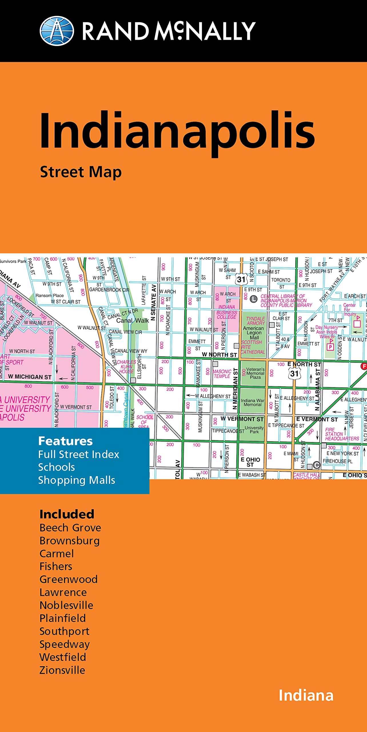
Rand McNally Folded Map: Indianapolis Street Map
$8.99
| Brand | Rand McNally |
| Merchant | Amazon |
| Category | Books |
| Availability | In Stock |
| SKU | 0528024981 |
| Color | Multicolor |
| Age Group | ADULT |
| Condition | NEW |
| Gender | UNISEX |
About this item
Rand McNally Folded Map: Indianapolis Street Map
Rand McNally's folded map for Indianapolis is a must-have for anyone traveling in and around this part of Indiana, offering unbeatable accuracy and reliability at a great price. Our trusted cartography shows all Interstate, U.S., state, and county highways, along with clearly indicated parks, points of interest, airports, county boundaries, and streets. The easy-to-use legend and detailed index make for quick and easy location of destinations. You'll see why Rand McNally folded maps have been the trusted standard for years. - Regularly updated. - Full-color maps. - Clearly labeled Interstate, U.S., state, and county highways. - Indications of parks, points of interest, airports, county boundaries, schools, shopping malls, downtown & vicinity maps. - Easy-to-use legend. - Detailed index & full street index. - Convenient folded size. Coverage Area Communities Included: Beech Grove, Brownsburg, Carmel, Fisher, Greenwood, Lawrence, Noblesville, Plainsfield, Southport, Speedway, Westfield, Zionsville. Product Details: Measures 9.5' x 4' and folds out to 40' x 28'.
| Brand | Rand McNally |
| Merchant | Amazon |
| Category | Books |
| Availability | In Stock |
| SKU | 0528024981 |
| Color | Multicolor |
| Age Group | ADULT |
| Condition | NEW |
| Gender | UNISEX |
Similar Products


Compare with similar items

LIPS: The Ultimate Coloring Book: Relaxi... |

Fallen Justice (Fallen Angel)... |

The Cat With The Bird Nest Hat: A Tale o... |

The Two Sided Coin: A Daughter's Chronic... |
|
|---|---|---|---|---|
| Price | $6.68 | $14.24 | $11.99 | $16.86 |
| Brand | Pharaphaen | William Price Jr | B N Pulido | Raychel A Hosch |
| Merchant | Amazon | Amazon | Amazon | Amazon |
| Availability | In Stock | In Stock Scarce | In Stock | In Stock |